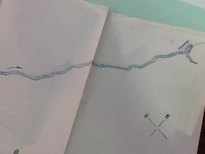
On recon patrols and other missions, engineers would draw their findings on a map overlay. This was used exactly like a transparency on an overhead projector. They would set it on the map, and there you have a detailed picture of the situation. This is depicted fantastically by Blood on the Talon;
http://castraponere.com/bloodonthetalon/29-jan-45-engineer-overlay-revisited/
This is a picture of an overlay drawn by members of the 24th Arm'd Engr. Bn.
It depicts the route of approach to Regan from Schwandorf, both located in Germany. The green colored line represents the road taken by armor of the division.
It depicts the route of approach to Regan from Schwandorf, both located in Germany. The green colored line represents the road taken by armor of the division.
The Germans also used overlays.
[1] On 13 November 1944, the second platoon of "B" Company captured a vital piece of intelligence at an over-run position of the 1125 Grenadier Regiment (559th Division). It was a map overlay depicting "all minefield locations, type, and number of mines in (word unreadable), bridge defenses." The overlay was sent up to Group HQ.
[1] "After-Action Report, Company B, 24th Armored Engineer Battalion, Period 1 November 1944-30 November 1944. From the Eisenhower Presidential Library.
[1] "After-Action Report, Company B, 24th Armored Engineer Battalion, Period 1 November 1944-30 November 1944. From the Eisenhower Presidential Library.


No comments:
Post a Comment